Ground truth, surveyed and delivered across India.
ORNET’s field survey division turns GPS, drone, LiDAR and total-station data into WebGIS that teams can act on, backed by four more divisions across census, healthcare, contact centres and campaigns.
GPS, drone, LiDAR and total-station survey across India, delivered as WebGIS and mobile GIS.
Drone / UAVLiDARTotal-stationWebGIS
Tree Census
Field enumeration, geo-tagging and canopy audit.
Healthcare
Field health delivery and programme support.
Contact Centres
Inbound and outbound voice, back-office and CX.
Political Campaigns
Field surveys, ground teams and campaign operations.
Trusted by
Delivering for government across Maharashtra.
Municipal corporations, councils and nagar parishads across the state have engaged ORNET for geospatial survey, tree census and field-services programmes.
Our flagship — Geospatial & GIS
From the field to a map your team can act on.
Our geospatial division runs the full chain — capture in the field, process to survey-grade accuracy, and hand back live GIS. One pipeline, instrument-agnostic, built for government and enterprise projects across India.
STAGE 01
Capture
Ground teams collect precise field data with the right instrument for the terrain and the deliverable.
GPS / DGPS ground control
Drone & UAV aerial survey
LiDAR point clouds
Total-station traversing
STAGE 02
Process
Raw field data is cleaned, georeferenced and turned into structured, auditable layers.
Orthophoto & DEM generation
Feature extraction & digitisation
Attribute tagging & QA
Survey-grade accuracy checks
STAGE 03
Deliver
Layers ship as GIS your team actually uses — on the web and in the field.
Alongside our flagship geospatial division, ORNET runs four more service lines for government and enterprise clients — each staffed and managed in-house.
Tree Census
Ward-by-ward enumeration and geo-tagging of every tree, with species, girth and canopy attributes captured for urban local bodies and forestry programmes.
EnumerationGeo-tagged inventoryCanopy audit
Healthcare
Field health delivery and programme support — ground staff, data collection and coordination for public-health and outreach initiatives.
Field deliveryProgramme supportData collection
Contact Centres
Inbound and outbound voice, back-office processing and customer experience — staffed and managed contact-centre operations for enterprise and government clients.
Inbound / outboundBack-officeCX
Political Campaigns
Ground-level constituency surveys, field teams and campaign operations — the same field muscle applied to voter research and on-the-ground execution.
Field surveysGround teamsCampaign ops
Sectors served
Buyer categories, not a client roster. Named projects and references appear under Selected work.
Government
Urban local bodies
Forest & environment
Health & sanitation agencies
Election & electoral rolls
Land records & revenue
Enterprise
Utilities & infrastructure
Real estate & development
Telecom networks
NGOs & research
Consulting & advisory
How we work
Ground-truth first, from field to finished GIS.
Good geospatial work is a chain of decisions, not a single deliverable. Here is how we move from the physical ground to data your team can actually use.
01
Ground-truth first
Field checks anchor every feature to reality before it becomes data.
02
Instrument-agnostic capture
We match the capture method to the terrain and the accuracy the work demands.
03
Structured, auditable data
A consistent schema keeps every feature traceable — where, when and how it was captured.
04
Delivered as usable GIS
You receive working GIS layers your team can query, edit and build on.
CAPACITY
500+ professionals and a full survey stack.
Field teams operate GPS, total station, drone, LiDAR and ground-penetrating radar. Data is captured on mobile GIS and delivered through WebGIS.
Professional employees
500+
Trees surveyed
1Cr+
Local governments served
29+
Leadership
Led by Ram Bhojane.
Chief Executive Officer & Managing Director
The team with him
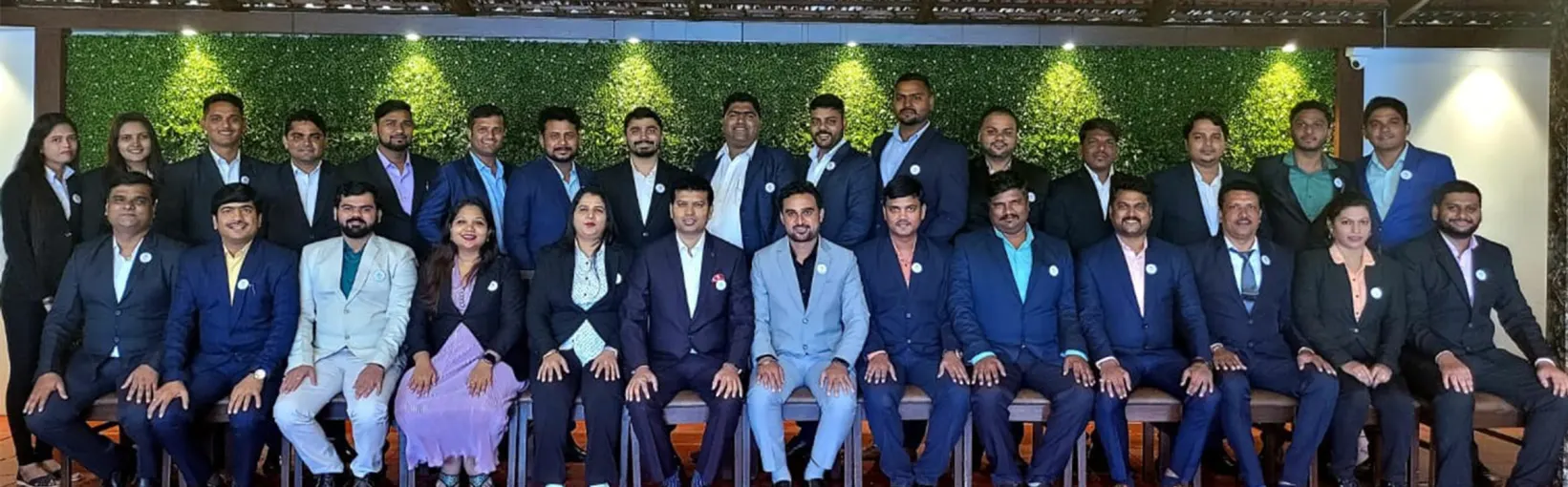
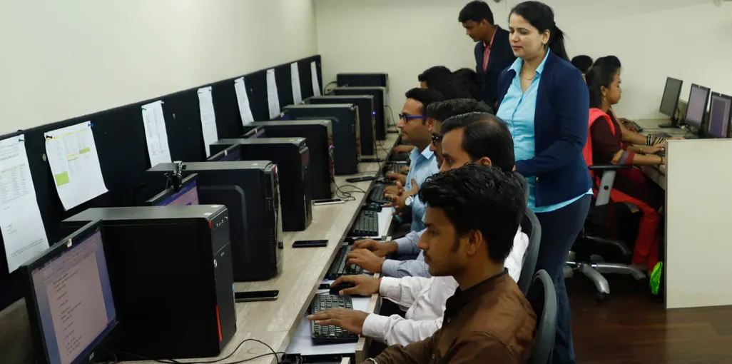
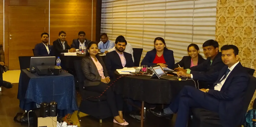
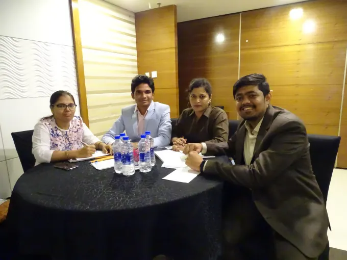
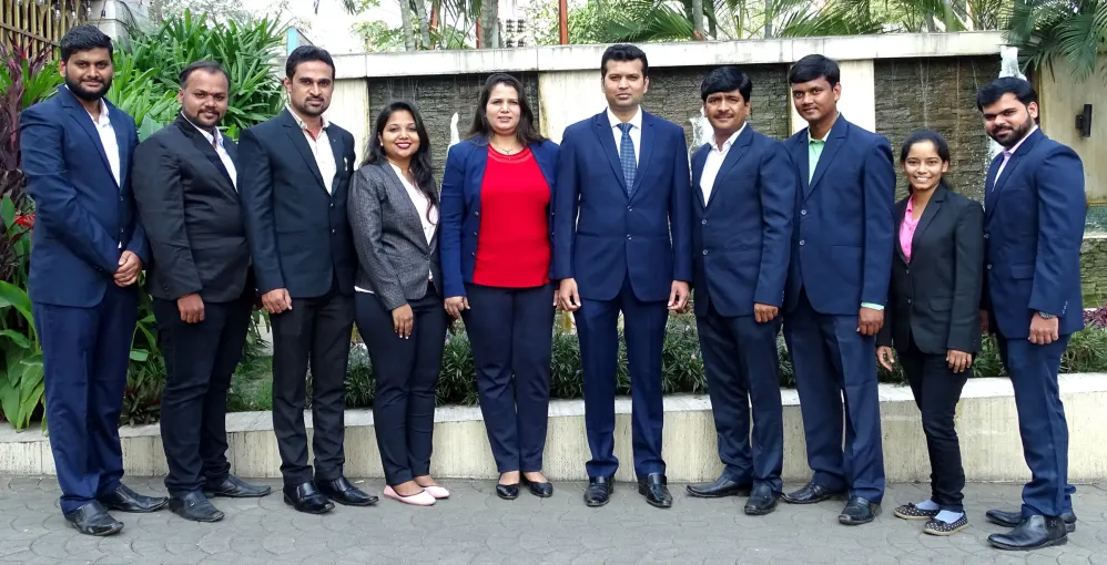
01The company. 500+ professionals across field survey, data processing and support.02Processing floor. Survey data is mapped in-house on ORNET’s own workstations.03Training session. Staff at an internal training session.04Project meeting. Four of the team at work.05The team. ORNET staff, photographed together.
FAQ
Questions buyers ask before they engage.
Straight answers to what procurement teams and enterprise buyers ask first. Anything with a specific figure or credential is confirmed on request rather than stated loosely.
Where do you operate?
Primarily municipal corporations and councils across Maharashtra. The deployment area for a given programme is scoped per engagement, and coverage beyond Maharashtra can be discussed.
Do you work with government or private clients?
Both. Public-sector buyers such as urban local bodies, forest and environment, health and election departments, alongside enterprise clients in utilities, real estate, telecom and consulting. The full list is under What we do above.
How is the data delivered?
As GIS-ready datasets, dashboards and mobile or office applications built around each programme’s field workflow. Specific formats and standards are agreed per engagement.
Are you set up for public-sector tenders?
Registrations, certifications and empanelment details are provided on request. Named references from earlier programmes are available on request.
Contact
Talk to the field-ops team.
Tell us the programme, the area and the deliverables. We’ll come back with how we’d staff it, run quality control on the ground, and hand it over as usable data.
Office
618, 6th Floor, Rupa Solitaire, Millennium Business Park, Sector 1, Mahape, Navi Mumbai, Maharashtra 400710